Web mapping done right.

I am a GIS specialist and web developer from Tartu, Estonia.
I enjoy building everything from maps-in-webpages to rich interactive GIS solutions. If you need help about collecting, analysing or presenting spatial information, you can get in touch with me here

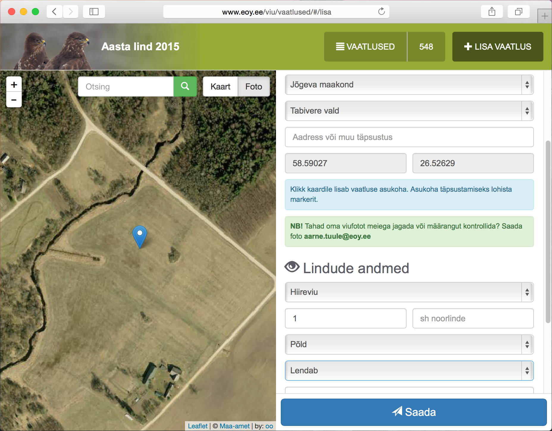
GIS for Estonian Ornithological Society: Collecting survey results

GIS solution for collecting and displaying sightings results for several Estonian Ornithological Society projects. Each project have it's own small HTML5/CSS3/JS application with Leaflet map. Data saving and publishing is done by GeoForms API server.

Live example: Bird of the year 2017
Read more about project (estonian): Geoforms in Estonian Ornithological Society
Find out more about Geoforms

  • html
  • js
  • require.js
  • leaflet
  • php
  • silex
  • mysql
Generic placeholder image

Geop: Geocaching tool for planning geotrips

Tool for Estonian Geocache game for planning geotrip. It uses Openlayers 3 map with OSM layers. Pure HTML5/CSS3/JS application. Will generate GPX-route from planned caches that gamer can load into GPS-device. Gamer can drag recorded GPX-track back to map for easyer cache logging.

Live: Geop
Github: Geop

  • html
  • js
  • openlayers
  • require.js
Generic placeholder image

Geopuzzle: Geographic game based on OpenLayers map

I made this game just for fun. It is based on OpenLayers 2 and jQuery, backend is written in PHP and geometries are hold in MySQL database.

You can play game online here: Geopuzzle
Read about spatial data preparation (estonian): Geopuzzle data setup

  • html
  • js
  • openlayers
  • php
  • mysql
Generic placeholder image


GIS future is JS
My presentation at ESTGIS 2013 annual conference
avatar